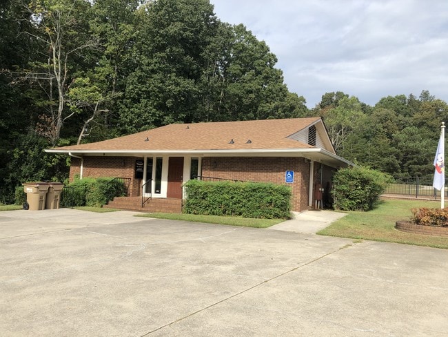
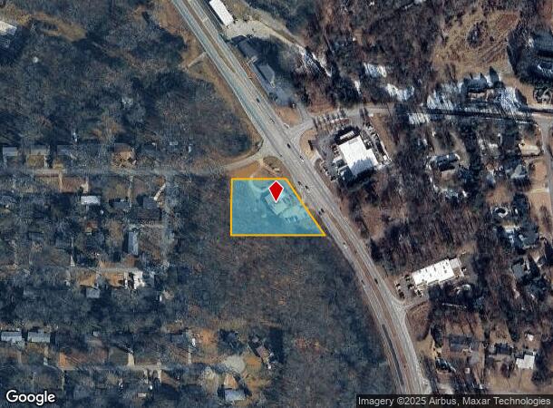
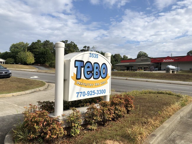
Property Record
3535 Thompson Bridge Rd, Gainesville, GA 30506
NEARBY LISTINGS FOR SALE OR LEASE
Property Detail
3535 Thompson Bridge Rd
Gainesville, GA
Country Club Garden Estates
10-00105-04-001
LTS 1&2, COUNTRY CLUB GARDEN
Medicalbuilding
Hall
X
Georgia
13139C0180G
1
2025
1.31 AC
2025
Gainesville/Hall County
000402
Atlanta
4,622 SF
DEMOGRAPHICS near 3535 Thompson Bridge Rd
1 Mile
3 Mile
5 Mile
2024 Total Population
4,239
17,346
47,121
2029 Population
4,697
19,226
52,325
Pop Growth 2024-2029
+ 10.80%
+ 10.84%
+ 11.04%
Average Age
44
43
41
2024 Total Households
1,652
6,640
18,293
HH Growth 2024-2029
+ 10.90%
+ 10.84%
+ 11.01%
Median Household Inc
$81,379
$76,970
$69,683
Avg Household Size
2.50
2.50
2.50
2024 Avg HH Vehicles
2.00
2.00
2.00
Median Home Value
$292,165
$305,564
$311,111
Median Year Built
1988
1989
1989
Nearby Places
Map Layers
Map Styles
 Street
 Aerial
- Restaurants
- Banks
- Shops
- Fitness
- Groceries
PUBLIC TRANSPORTATION
COMMUTER RAIL
Gainesville Amtrak Station (Crescent - Amtrak)
DRIVE
WALK
Distance
Gainesville Amtrak Station (Crescent - Amtrak)
10 min
6.5 mi
Freight Ports
Georgia Ports - Savannah
DRIVE
WALK
Distance
Georgia Ports - Savannah
324 min
256.6 mi
SALE & LEASE HISTORY
LISTING DATE
SALE/LEASE

Oct 09, 2019
For Sale
Nov 22, 2019
For Lease
Nearby Properties
Address
Land Use
TOTAL SIZE
Lot Size
Zoning
Address
Land Use
TOTAL SIZE
Lot Size
Zoning
163,951 SF
19.10 AC
AR-1
Address
Land Use
TOTAL SIZE
Lot Size
Zoning
56,780 SF
16.78 AC
PUD
Address
Land Use
TOTAL SIZE
Lot Size
Zoning
54,720 SF
32.52 AC
R-II
Address
Land Use
TOTAL SIZE
Lot Size
Zoning
113,288 SF
46.89 AC
AR-1
Address
Land Use
TOTAL SIZE
Lot Size
Zoning
11,920 SF
25.80 AC
R-1
Address
Land Use
TOTAL SIZE
Lot Size
Zoning
1,628 SF
10.41 AC
PUD
Address
Land Use
TOTAL SIZE
Lot Size
Zoning
90,044 SF
11.23 AC
PCD
Address
Land Use
TOTAL SIZE
Lot Size
Zoning
93,869 SF
10.40 AC
PUD
Address
Land Use
TOTAL SIZE
Lot Size
Zoning
118,564 SF
2.97 AC
PUD
Address
Land Use
TOTAL SIZE
Lot Size
Zoning
26,480 SF
10.08 AC
O-I
Address
Land Use
TOTAL SIZE
Lot Size
Zoning
20,850 SF
8.76 AC
PUD
Address
Land Use
TOTAL SIZE
Lot Size
Zoning
163.30 AC
R-I-A
Address
Land Use
TOTAL SIZE
Lot Size
Zoning
1,457 SF
9.71 AC
R-II
Address
Land Use
TOTAL SIZE
Lot Size
Zoning
53.42 AC
R-I-A
Address
Land Use
TOTAL SIZE
Lot Size
Zoning
27,750 SF
9.56 AC
R-II
Address
Land Use
TOTAL SIZE
Lot Size
Zoning
60,426 SF
7.13 AC
PUD
Address
Land Use
TOTAL SIZE
Lot Size
Zoning
57,416 SF
7.65 AC
PCD
Address
Land Use
TOTAL SIZE
Lot Size
Zoning
29,845 SF
9.39 AC
AR-1
Address
Land Use
TOTAL SIZE
Lot Size
Zoning
52,712 SF
4.60 AC
G-B
Address
Land Use
TOTAL SIZE
Lot Size
Zoning
4.23 AC
PCD
Address
Land Use
TOTAL SIZE
Lot Size
Zoning
52,986 SF
3.26 AC
PUD
Address
Land Use
TOTAL SIZE
Lot Size
Zoning
1,440 SF
69.85 AC
R-I
Address
Land Use
TOTAL SIZE
Lot Size
Zoning
14,962 SF
4.79 AC
POD
Address
Land Use
TOTAL SIZE
Lot Size
Zoning
34.81 AC
POD
Address
Land Use
TOTAL SIZE
Lot Size
Zoning
29,505 SF
9.43 AC
V-C
Address
Land Use
TOTAL SIZE
Lot Size
Zoning
13.09 AC
R-I
Address
Land Use
TOTAL SIZE
Lot Size
Zoning
10,016 SF
10.72 AC
R-1
Address
Land Use
TOTAL SIZE
Lot Size
Zoning
220.23 AC
AR-1
Address
Land Use
TOTAL SIZE
Lot Size
Zoning
8,746 SF
2.08 AC
AR-1
Address
Land Use
TOTAL SIZE
Lot Size
Zoning
12,996 SF
2.93 AC
PCD
The World's #1 Commercial Real Estate Marketplace
Connect with us
© 2025 CoStar Group
The information above has been obtained from sources believed reliable. While we do not doubt its accuracy we have not verified it and make no guarantee, warranty or representation about it. It is your responsibility to independently confirm its accuracy and completeness. Any projections, opinions, assumptions, or estimates used are for example only and do not represent the current or future performance of the property. The value of this transaction to you depends on tax and other factors which should be evaluated by your tax, financial, and legal advisors. You and your advisors should conduct a careful, independent investigation of the property to determine to your satisfaction the suitability of the property for your needs.